Weather warnings are in place for Ireland and the UK as the newly-named Storm Debi is set to bring heavy rain and strong winds.
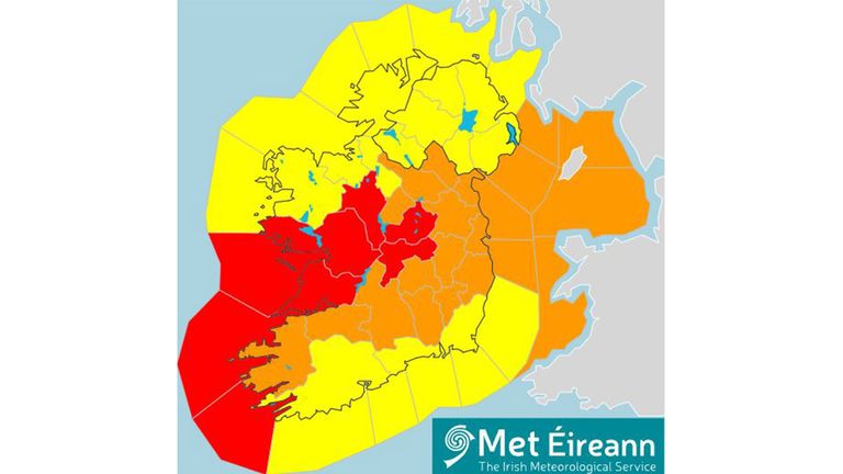
A handful of locations, including the whole of County Clare, east Galway, south Roscommon, Offaly and Westmeath, are subject to red wind warnings – the highest level possible – for Monday morning.
The Irish weather service, Met Eireann, has also issued a red warning for just off the coast of the counties of Clare, Limerick and Kerry ahead of “violent” storm force 11 winds – just one grade below hurricane force. This covers 2am to 5am on Monday.
The storm was officially named by Met Eireann on Sunday morning and this is the earliest in the season that a storm in alphabetical sequence beginning with the letter ‘D’ has ever hit the British Isles.
The agency has warned that there’s a risk of “severe and damaging gusts” of wind from Sunday night.
A yellow wind and rain warning is in place for the whole of Ireland for Monday, with Met Eireann warning that it will be “very windy or stormy” amid heavy rain and possible thunderstorms and hail.
The warning comes into effect from midnight and finishes at 3pm on Monday 13 November.
A more severe orange wind warning is in place for 16 Irish counties and covers the period between 2am and midday on Monday.
In the areas where the red warnings are in place, Met Eireann said that there was a “potential danger to life”.
What’s the weather forecast in your area?
An orange warning is in place from 1am to 5pm for the Irish Sea, where southwesterly winds will reach storm force 10.
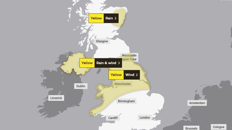
Meanwhile, the Met Office has issued a yellow wind and rain warning for the whole of Northern Ireland for Monday, advising that Storm Debi may cause travel disruption as well as the flooding of homes and businesses.
It is also urging people to be wary of possible fast-flowing or deep floodwater and flying debris, which could cause a danger to life. The storm may also cause power cuts.
The weather warning for Northern Ireland comes into effect at 3am on Monday and finishes at 2pm.
Yellow warnings for rain and wind have also been issued for the north of England, the Midlands, North Wales and the northeast of Scotland, covering areas including Bangor, Sheffield, Liverpool and Aberdeen.
Storm Debi is the earliest ‘D’ storm to impact the UK and the Republic of Ireland since the countries began naming their storms in alphabetical order in 2015.
The storm season begins in September and, until now, the earliest ‘D’ storm named by them was 2015’s Storm Desmond, which arrived on 4 December.
The UK and Ireland were also hit by Storm Diana on 28 November 2018, which was named by Portuguese weather service the IPMA.
‘In the firing line for wet and windy spells’
Sky News weather forecaster and presenter Kirsty McCabe said: “We’ve had a very unsettled autumn with a succession of deep low-pressure systems affecting the UK, all thanks to the position and strength of the jet stream.
“This fast-moving ribbon of strong winds high in the atmosphere steers low-pressure systems on the ground, and right now a very strong jet is lying across the south of the British Isles.”
Adding that “we’re in the firing line for wet and windy spells” on Monday, she continued: “It won’t take much more rain to cause further flooding in those areas that suffered during previous storms.
“Until the position of the jet changes or weakens, there could be further low-pressure systems to come this week once Debi moves through.”
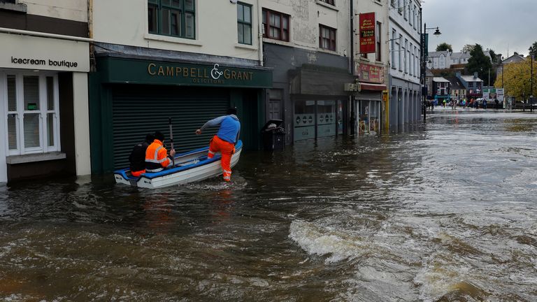
Storm Debi’s arrival comes after parts of Ireland and the UK were devastated by floods during the preceding storms, Babet and Ciaran.
Read more from Sky News:
King leads Remembrance Day service at Cenotaph
Met asks for help identifying protesters with ‘hate crime’ placards
The record-breaking Storm Ciaran battered the Channel Islands with hurricane-strength gusts of 104mph just weeks ago, leaving flights to them cancelled.
Areas of Ireland and England also suffered damage, with 10,000 homes in Cornwall being left without power while hundreds of schools were forced to close.


